Overview
Electronic warfare operations in the Persian Gulf are disrupting ship movements through the Strait of Hormuz, a critical chokepoint for global oil and LNG flows. The combined effect of kinetic attacks and persistent signal jamming has made transit through the waterway significantly more hazardous.
What is happening
Shipping traffic through the strait - the narrow channel between the United Arab Emirates and Iran - has effectively collapsed amid the conflict involving the US and Israel against the government in Tehran. The region has seen missiles and drone strikes that have produced eight attacks and multiple fatalities on oil tankers operating in the Persian Gulf.
Alongside these physical assaults, widespread electronic interference is complicating navigation. Attackers have employed jamming techniques that scramble Global Positioning Systems, degrading the satellite signals mariners rely on for positioning. The jamming campaign reportedly began at the outset of the conflict and has, in recent days, affected over 1,100 ships operating in the Persian Gulf, according to maritime intelligence firm Windward.
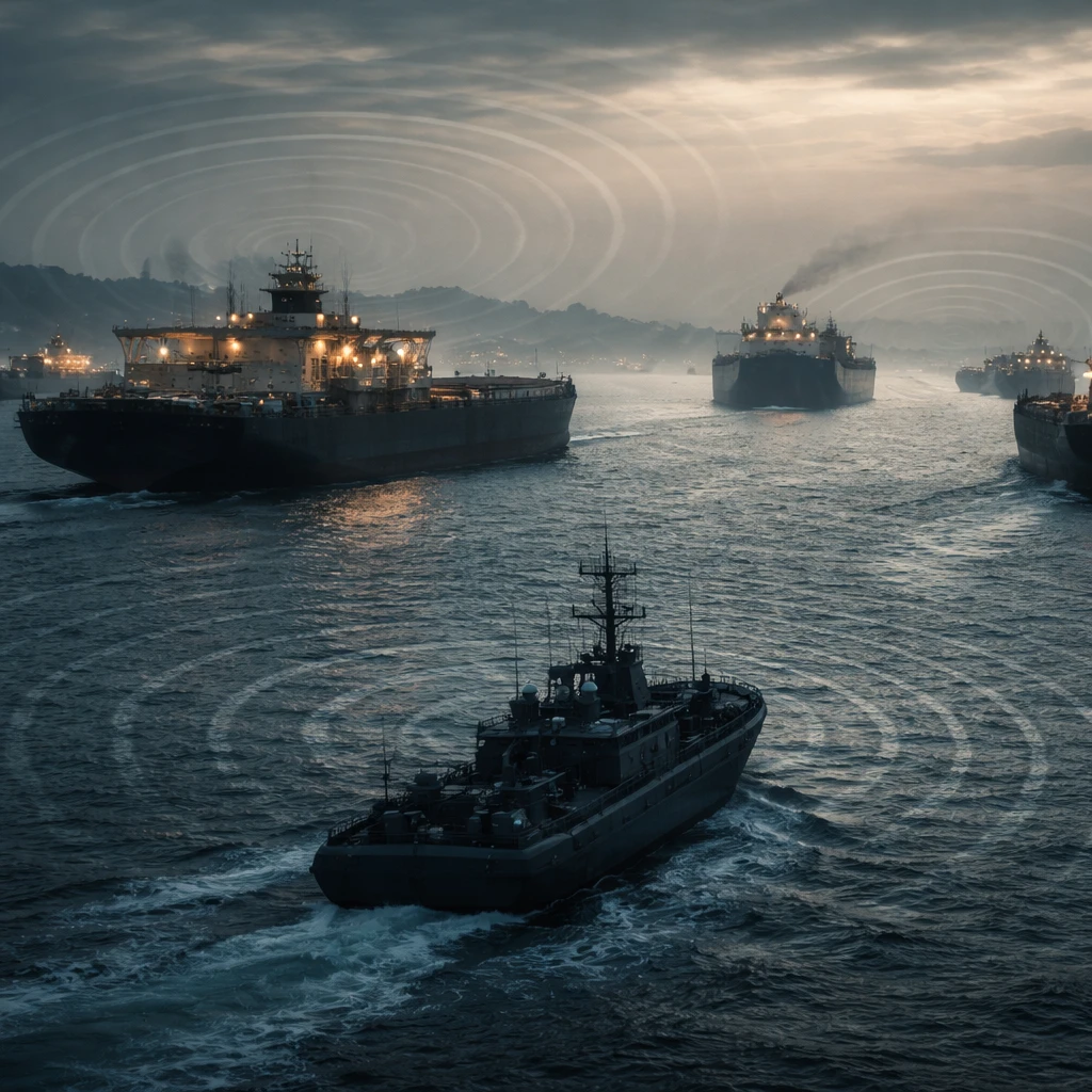
Navigation systems impaired
The signal disruption extends beyond GPS. Automatic identification systems, or AIS - which are crucial for vessel tracking and safe navigation - are also being impacted by the electronic interference. With both GPS and AIS degraded, the margin for safe maneuvering through an already narrow and heavily trafficked strait is reduced.
Compounding the risk, multiple vessels in the area have been subjected to direct physical attacks. The combination of kinetic threats and electronic warfare has created a maritime environment in which routine navigation practices are unreliable and collision risk is elevated.
Implications
As the conflict continues, the intersection of missile and drone strikes with systematic signal jamming has upended normal shipping patterns through one of the world’s most important energy transit corridors. Mariners and maritime operators face both the immediate peril of physical attack and the navigational challenges posed by degraded satellite and identification systems.
Reporting in this article relies on the accounts and figures presented by maritime intelligence and reporting cited in public accounts of the situation.